Crabtown Cache
| This
Cache is located along the Trans Canada Trail within view of one of
Burnaby's historical areas. Unfortunately, there is nothing
but a sign
to mark the site of one of Canada's most unique communities. Crabtown was born during the housing shortage of 1912 when a group of mill employees, in need of affordable accommodation, built a few shacks on piers along the oceanfront. Since the area was so isolated, neither the city nor the harbour authority (whom owned the property) bothered to evict the squatters. As time passed, families joined the squatters camp, enlarging the size of the individual shacks and tripling the population of Crabtown itself. |
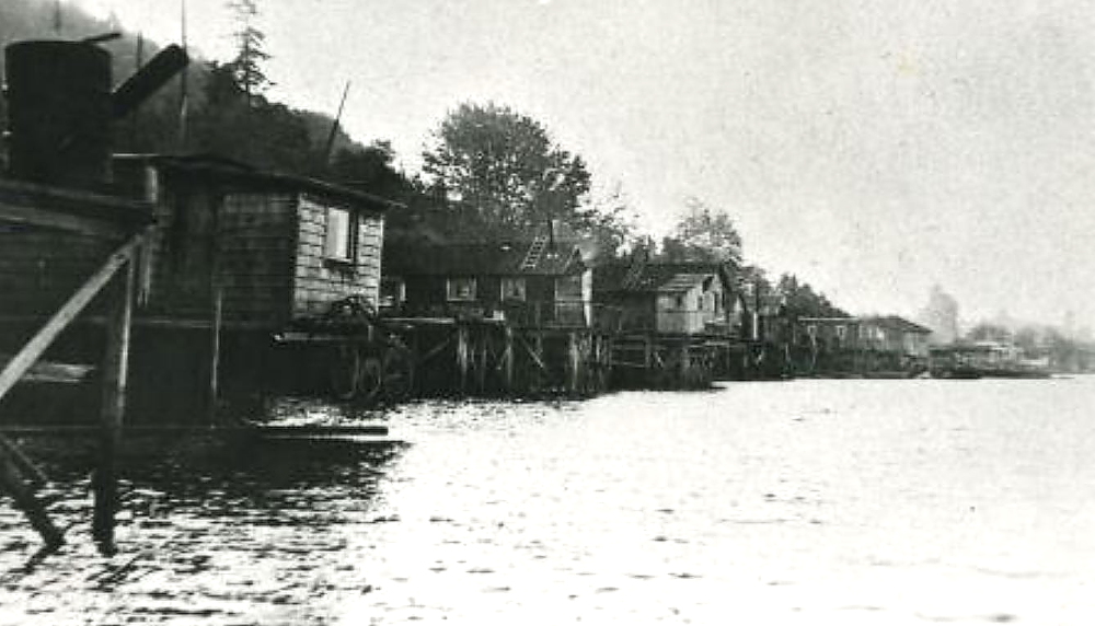
| Crabtown
was by no means a slum. The people were indeed poor but they
took
great pride in the community they created. By the 1930s, the
inhabitants built a stairway up the bluffs, piped in a fresh water
supply and constructed a boardwalk along the shoreline. Porch
gardens and flower boxes were commonplace alongside the colourfully
painted shacks on stilts. |
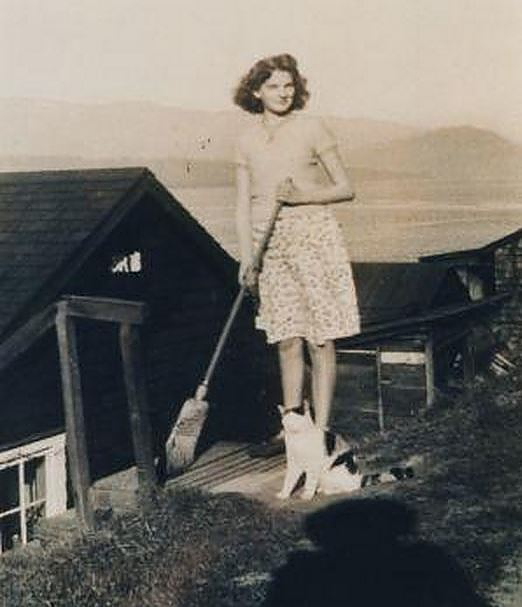
| It
has been said that the inhabitants of Crabtown were as colourful as the
houses they built. Folk Art in Burnaby was perhaps at its
height during Crabtown's heyday as people made what they could with
whatever washed ashore. Visitors were welcomed and crafts were often
sold along the boardwalk. People living in the community itself often joked that they had all the modern conveniences -- iceboxes (in the winter) and toilets that flushed (in and out with the tide). In reality, life was not much different than that of the original pioneers. Electricity was non-existent and the nearest public phone was a walk up the bluff to Hastings Street. During storms at high tide, waves would wash up and through the floorboards. Still, Crabtown was a clean, honest and proud neighbourhood. One day in 1957, the 150 families living in Crabtown were given eviction notices and within the next few months, the inhabitants were relocated to various government assisted housing complexes across the city. With that, Crabtown was hastily dismantled. |
 |
| On another note, this area is historically significant for another reason. The Trans Canada Trail that flows through Burnaby Heights is what is left of an unfinished mega project which was to be started in the 1930s and finished before the 1950s. |
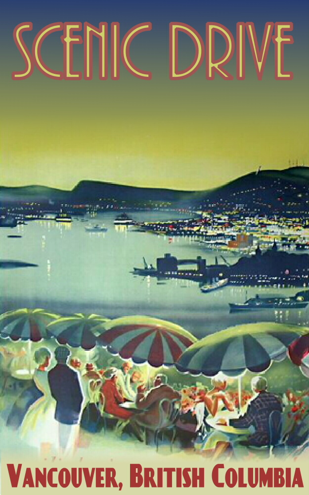 |
Notice
how the street grid is broken in places by by a diagonal road and
linear parks. This interruption in the road system is part of
what was to be North Burnaby's section of "Scenic Drive."
Toted as a tourist automobile roadway, Scenic Drive was designed to
connect beautiful views and major points of interest in a circular
route starting and ending in downtown Vancouver. Restaurants, marinas,
golf courses and public beaches would be found along the way. The route
itself would have skirted through north Burnaby and beyond to Port
Moody where it would have veered north and followed the shoreline all
the way up one side of Indian Arm and down the other. From
there the road would have gone through North Vancouver to Horseshoe bay
and back down Marine Drive (already famous for its scenic beauty) over
the Lions Gate Bridge to Downtown Vancouver. Taking the
average driver one day to complete, the Scenic Drive route was to be
the ultimate in urban to nature automobile travel. A family
could start off in the morning, experience the wilds of British
Columbia, and be home in time to put the children to bed. The idea of automobile tourism was relatively new at the time Scenic Drive was conceived and all municipalities involved along the route were very much in favour of this "modern" project. Construction on the road was started in several municipalities but the Great Depression got in the way. A tourist roadway was thought of as flippant excess during a time of widespread poverty. World War II halted the project even longer but there was renewed interest with the instant popularity of Route 66 and New York City's Parkways. |
| But
by that time Vancouver was growing rapidly and beginning to suffer from
rush-hour gridlock. Highways and transit became the focus of
the planning commission and Scenic Drive was eventually forgotten. For those interested in experiencing what it may have been like to travel along Scenic Drive, part of it exists in North and West Vancouver. Enjoy the view. |
| HISTORY TOUR | HOME |