Ghosts of
Barnet
| In the crisp
autumn twilight of 2003, two friends hiking through the trails of
Belcarra looked across the waters of Burrard Inlet to see lights
through the evening mist. Knowing the area well, they were
sure they were not seeing Port Moody nor the lights originating from
nearby oil refineries. As they studied the area further, a
silhouette of a small town came clearly into view -- dim lights
flickered in the windows. The hikers had every right to be concerned, for they knew the mirage they were experiencing couldn't be real. The town of Barnet was abandoned and torn down over forty years earlier. Still, they saw homes, small commercial buildings, smokestacks and what appeared to be movement along a far off street. Thinking that perhaps a local studio had constructed a movie set, they hopped into a car and travelled along the Barnet highway to investigate. They found nothing but darkness and a closed park. The area known as Burrard Inlet has been a hotbed for unusual sightings. Ancient legends tell of the coastal mountains transforming before people's eyes. Perhaps the most famous documented story is Pauline Johnson's account of a "lost island" not far from the old Barnet town site that is said to appear and disappear. |
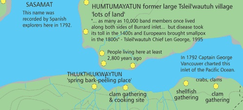 |
Burrard Inlet is the ancestral lands of several First Nations. Known as an ancient cultural and spiritual mecca, the unique climate allowed for an early berry harvest while the sheltered coastline supported an abundance of shellfish. Clam middens found in the area date back as far as 3,000 years. Mystical legends describing the area are in abundance. |
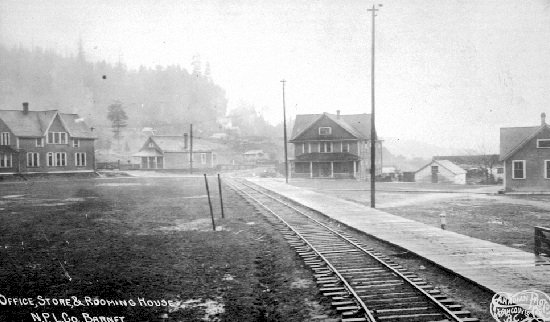
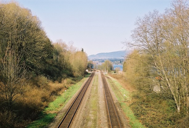
| This cache is located in Barnet Marine Park on the lands once occupied by the town of Barnet. If
you park in the overflow lot on the west side, there is a pedestrian
bridge over the railroad tracks. The photographs below depict
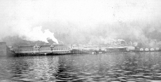
what the area looking west to the Kask Bros land would have looked like 100 years ago and what
it looks like today. |
|
 |
| By
1909, the town boasted two general stores (one private and one
belonging to the North Pacific Lumber Company), a telegraph & post
office, a CPR station, a school, police enforcement, electricity and
indoor plumbing. With a population of 250, Barnet was truly one of
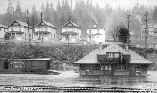
Canada's most modern towns. In 1905, the pedestrian bridge would have been close to the entrance of the second largest sawmill in British Columbia. The parking lot and grassy lawns to the south and east along the highway is all that is left of residential Barnet. While walking on the pedestrian bridge, take a look back to the parking lot. The photographs below are close to the same view of the Barnet slopes looking south towards Burnaby Mountain. |
 |
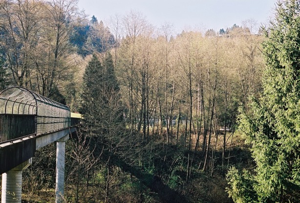 |
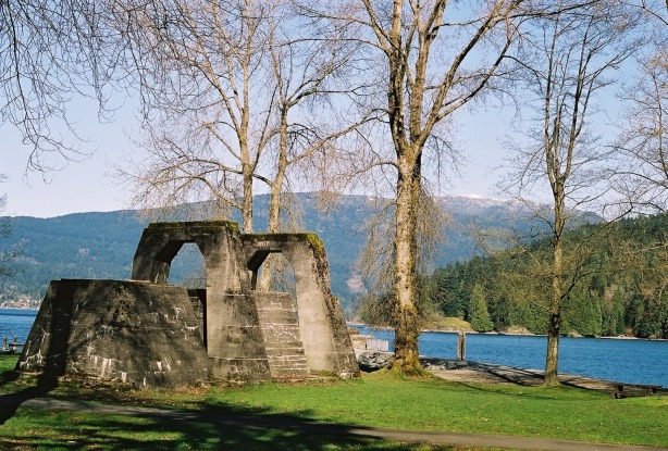
| Over
the bridge, the concrete path under your feet is all that remains of
the original mill road. The large structure jutting from the
manicured lawn was once the foundation for the sawmill's
machinery. On the waterfront, the remains of the sawmill's furnace is a
nice spot to take in the view. If you ever wanted to go back to a simpler time, this wouldn't be the place to do it. By the 1920s, the surrounding forest was clear-cut as far as the eye could see. Noisy sawmills, oil refineries and foundries spewed tons of coal smoke into the air. Pollution and frequent mudslides caused by deforestation turned ocean and sky into a perpetual shade of brown The Barnet/Port Moody area was not the place of picture postcards. | 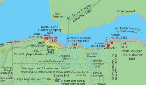 |
 |
 |
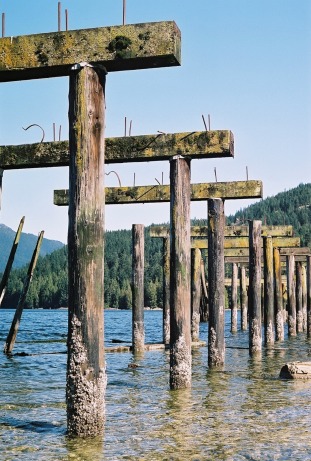 | Continue
west along the seaside trail and you will discover what is left of the
docks. This is where processed timber bound for American
and Asian ports was loaded onto ships. Today, the birds find the
pylons a great place to make nests. This area is now a seasonal
off leash park for dogs. Further along the trail, piles of rubble become more evident. This area has not yet been fully rehabilitated into parkland. Along with a few buildings, much of the old barnet road was bulldozed onto the shoreline during the Barnet Highway expansion of the 1990s. The seaside trail itself is partly built on newly claimed landfill from that construction project. You may notice a chimney stack, a porcelain sink or two, or sheet metal from an old building amongst the road debris. The first financial woes to hit Barnet took place during the Great Depression. It was at this time that the demand for lumber dropped drastically. To add to the town's troubles, the saw mill burnt to the ground. A small replacement mill was rebuilt quickly but the newly named Kapoor mill never managed to grow to the status of its predecessor. By 1958, the cost of barging in trees from increasingly distant areas of the province forced the mill to close down. The town slowly died within thirty years after that. The city of Burnaby bought up most of the land in the area for use as parkland. Today, Barnet Marine Park is in its first phase. As the remaining industrial businesses move out, the park will eventually stretch from Hastings St. to the current Petro Canada refinery and beyond to Port Moody. One hundred years after its heyday, the town of Barnet has been virtually wiped off the map. |
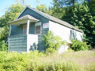
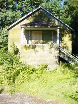
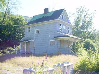
| When this cache was placed in 2005, there were still homes, albeit abandoned, on the south side of the highway. They've since been demolished and replaced with a parking lot and a mountain bike park. |
 |  |  |
| Nature
has presented its own unique epitaph to the town of Barnet. In
the springtime, look to the grassy fields and you'll witness a strange
phenomenon. Like grave markers, gardens planted long ago still
pop through the grassy fields and line the perimeter of long demolished
homes. Reminders of the town are everywhere if you know where to
look. As for the ghostly sightings, most people dismiss them as atmospheric phenomena. Other people swear that paranormal activity in the area, being well documented for centuries, can very well recapture the spirit of a town's last breath as it is being unceremoniously wiped off the face of the planet. For those with an open mind that dare to hunt for the cache at twilight, perhaps the spirit of Barnet will reveal itself to you. Enjoy your visit. |
| BURNABY HISTORY TOUR | HOME |