|
A historical journey of
"THE YANKEES
ARE COMING!"
Traditional Cache --
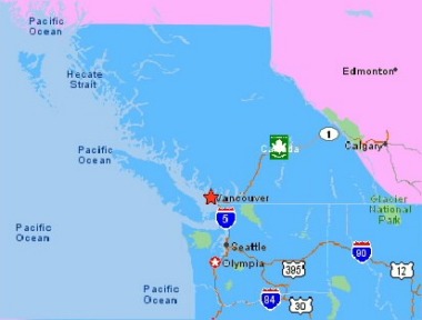
North
Burnaby
N49 16.910 W 122
53.656

This Cache is
located
in Burnaby Mountain Park along an abandoned section of North Road.
* * * * * * * * *
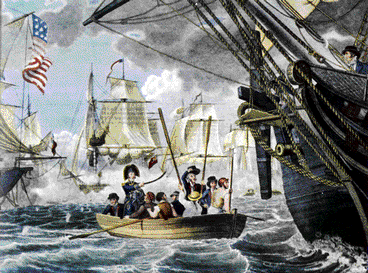
After James Polk
won the
1845 presidency of the United States with the slogan "54 40 OR FIGHT,"
the British had a good reason to become nervous. Polk basically
claimed
the lands of New Caledonia up to the 54th Parallel for the United
States.
This placed the American Border half-way up present day British
Columbia
from the southern tip of the Alaskan panhandle east to the
Rockies.
Britain, through the Hudson's Bay Company, had a good claim on all
lands
North West of the Columbia River (present day Western Washington State).
 Polk's
claim
Polk's
claim
|
 British
(HBC) claim
British
(HBC) claim
|
  The
War of 1812 was still fresh in memory. America was winning the
race
for Western expansion and the British knew that if they were to
maintain
a North American colony from the Atlantic to the Pacific they had to
use
it or loose it. The
War of 1812 was still fresh in memory. America was winning the
race
for Western expansion and the British knew that if they were to
maintain
a North American colony from the Atlantic to the Pacific they had to
use
it or loose it.
 |
The
capital of Fort Langley was said to have its back to the Americans so a
fledgling town situated strategically on the north branch of the Fraser
River was chosen to be the new seat of government. To exert
British
sovereignty, the town was given the name New Westminster after London's
Parliament. New Caledonia was renamed British Columbia. The
British knew that a symbolic gesture wouldn't be enough to thwart a
Yankee
invasion, however. More had to be done.
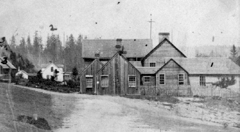
The
Photograph to the left shows the first government buildings of New
Westminster.
|
| Luckily
for the British, America's military was heavily engaged in fighting
both
the First Nations and the Mexicans. Knowing that a war on three fronts
could drastically hurt expansion, President Polk agreed to a peaceful
compromise.
The 49th parallel (already in place East of the Rockies) was accepted
as
the official border to the Pacific Ocean. But in the era of the
"Manifest
Destiny" there was concern that America would again revert its
attention
to Canada after the Southwest was won. |
 |
 By
1857, an invasion of a different type was well under way. The
discovery
of gold along the Fraser river brought a flood of Yankee prospectors
who
had little regard for British Law. Numbering over 30,000 by the
summer
of 1858, Governor James Douglas commented that ‘they are represented as
being with some exceptions a specimen of the worst of the population of
San Francisco – the very dregs in fact of society.’ It was widely
believed that if called for action the newly landed migrants would not
hesitate to fight on the side of the United States. British
Columbia
would easily fall into American hands. By
1857, an invasion of a different type was well under way. The
discovery
of gold along the Fraser river brought a flood of Yankee prospectors
who
had little regard for British Law. Numbering over 30,000 by the
summer
of 1858, Governor James Douglas commented that ‘they are represented as
being with some exceptions a specimen of the worst of the population of
San Francisco – the very dregs in fact of society.’ It was widely
believed that if called for action the newly landed migrants would not
hesitate to fight on the side of the United States. British
Columbia
would easily fall into American hands.
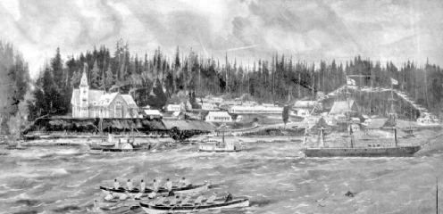
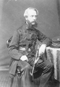
| The
Fraser river was known to jam with ice during the winter. This
would
be problematic in the advent of war. In order to assure
year-round
shipping supplies to reach the new capital, an elite band of Royal
Engineers
led by Richard Clement Moody (photograph on right) were deployed to the
area. Arriving in 1858, four hundred engineers set up camp
just north of New Westminster with orders to maintain law and order,
map
the area, conduct surveillance on the newly landed Yankees, and most
importantly,
build a network of roads to the ocean. The area now known as
Sapperton
is named after the saps (spades) the engineers carried with them.
Their camp is pictured in the photograph above.
Time
was of the essence so British Columbia's first thoroughfare
(Westminster
Road/North Road) was cleared and constructed along the shortest route
between
the two points. A longer secondary road (Kingsway) was planned to
link New Westminster with present day False Creek with a military camp
centred on the highest ground (now Central Park).
|
 |
At this time
another war
was brewing. With the possibility of loosing the Southern States,
America was forced to pull its military resources inward. A civil
war would halt American expansionism for several years. This gave
Britain some breathing room. It is little known that Britain's
resources
were so overtaxed defending colonies around the world, Queen Victoria
declared
British Columbia expendable. The militarial role in Western
Canada
was little more than posturing.
Whether
Britain's ploys
were successful in thwarting an enemy attack is in question but the
same
tactics were used when the ownership of Vancouver Island was in
question.
This is why Victoria is the Capital of British Columbia today.
If anything
came out of
Polk's decree it was Canadian nationalism. Knowing that Britain's
interest in Canada was increasingly waning, the colonists began to band
together to form their own nation. By the end of the American
Civil
War, Canada was well on the path towards self-government.
Canadian
Confederation in 1867 would halt any chance of an easy victory for the
sects of Yankee society that believed in Manifest Destiny.
After
construction, North
Road spawned several towns along Burrard inlet. Alliceville,
Barnet
and "fashionable" Port Moody (named after R.C. Moody -- streets named
after
his children and grandchildren) were linked to New Westminster by
British
Columbia's first urban transit system -- a stagecoach. The many
fruit
orchards planted along the route made the road's mid section a very
popular
picnic destination during blossom time.
With flatter
routes available,
the steep Burnaby Mountain section of North Road was eventually
abandoned.
Aliceville's well known hotel (some say brothel) at the foot of North
Road
has long since vanished under the Petro Canada refinery while a
mountain
stream has found a new path in the road's trench. Kids on
mountain
bikes now zoom over the stage coach route.
THE CACHE
 |
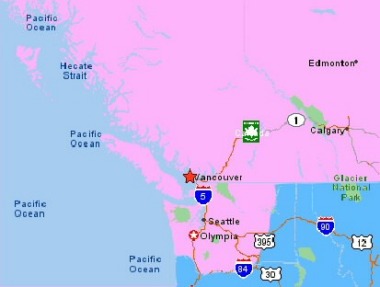
The
Closest available parking is located at:
N49
16.464 W122 53.614
This
small lot only holds four cars and can be busy at the best of
times.
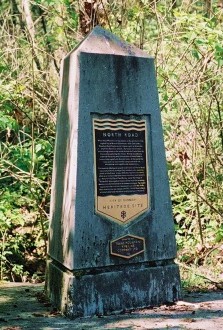
North along the road and trail, you'll spot a monument to North Road at:
N49
16.589 W122 53.629
From
there, you have two trail options and more options as you follow either
trail. Most routes will eventually take you to the cache but if
you
would like to make it a short trip, use your best judgement and
remember
the Cache's theme.
|
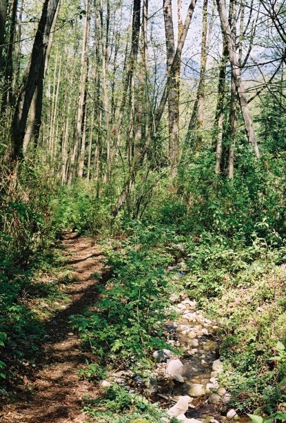
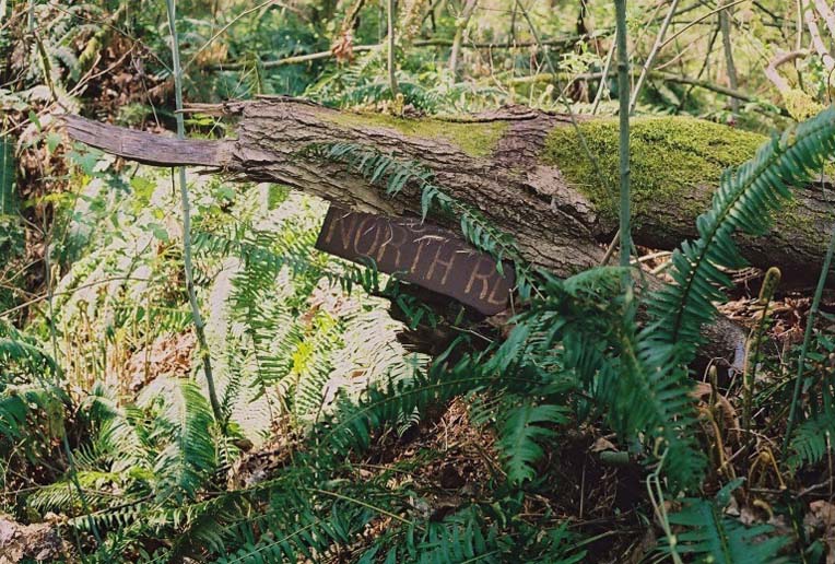
  If
you're on the right track you will eventually follow a stream (dry in
the
summer) that flows through part of North Road's original route.
Note
that the access roads used by the refinery next to the park also use
some
of the lands occupied by the original route. Depending on which
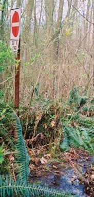
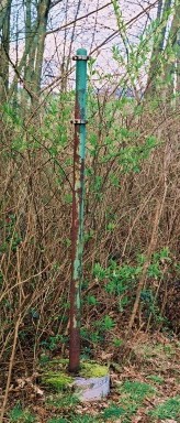
direction
you come from, you may spot some old relics from the days the road was
in use. There are several old signposts standing in the forest. If
you're on the right track you will eventually follow a stream (dry in
the
summer) that flows through part of North Road's original route.
Note
that the access roads used by the refinery next to the park also use
some
of the lands occupied by the original route. Depending on which
direction
you come from, you may spot some old relics from the days the road was
in use. There are several old signposts standing in the forest.
SPOILERS AHEAD
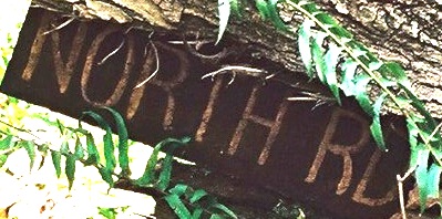
The cache is
about 8 meters
off the creek trail so to minimize any possible damage to the flora due
to the search, I have placed a sign in the general cache
location.
It is easily seen from the trail if you know where to look but I
suspect
the sign will become hidden as the foliage gets thicker. Please
remember
that there is always a way through an urban forest without bushwhacking
or trampling the flora.
Look for a
small stand
of large deciduous trees. The northernmost tree has snapped about
a storey and a half up. The cache is where the top part of the
tree
has fallen.
|