|
Multi Cache -- North Burnaby N49 14.412 W122 57.229
Remember the
good old
days of train travel when a conductor would walk the aisles and punch
passenger's
tickets? This cache is designed to take you back in time when
riding
the rails was not just a pleasure but an adventure.
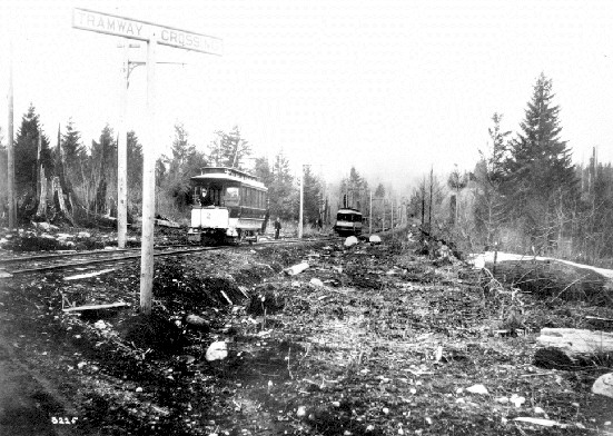
The development spawned by the Interurban was so great the British Columbia Electric Railway Company decided to buy up more land and expand the service. One popular route spread out to Richmond via the Arbutus corridor. But when the Burnaby Lake Line was opened in 1911, the economy slowed to a standstill. The sprawling suburb planned for the south side of Burnaby lake was stalled due to the depression of 1912. Only a few homes were built. Because of this, the Burnaby Lake Line was considered the scenic route and the dark horse of the system. After that, engineers and city planners decided to take a cautious approach and only built new lines where development already existed.
There was another type of depression that halted development in the area. Before flood controls were put in place, the Burnaby Lake lowlands were primarily bog and swamp. Unstable land in the area caused one train to sink -- taking the life of one engineer, several chickens and a goat. A mud slide caused a major derailment along the Brunette River killing 28 men. In an effort to alleviate slumping tracks and sinking trains, some sections of the Burnaby Lake Line were designed to float on a tightly packed bed of wood chips. With the
exception of
the interurban and suburban routes, much of the trolley system used
existing
roadways. The increasing popularity of the Automobile throughout
the 20th century began to result in a general feeling that trolleys and
cars could not co-exist. The most common complaint by motorists
concerned
the tracks themselves. Automobile wheels often got stuck in the
track
grooves causing motorists to unwittingly swerve the automobile down the
trolley line. Numerous accidents were blamed on this phenomenon.
The Trans Canada Highway, using the same "floating" roadbed design, was built along much of the Burnaby Lake Line's path in 1963. That particular section of the highway virtually floats over the swampland and will rise and fall with changes in the water table. Motorists that commute along the highway daily are aware of its fluidity. During inclement weather cycles, bumps and dips in the pavement will appear and disappear from one week to the next.
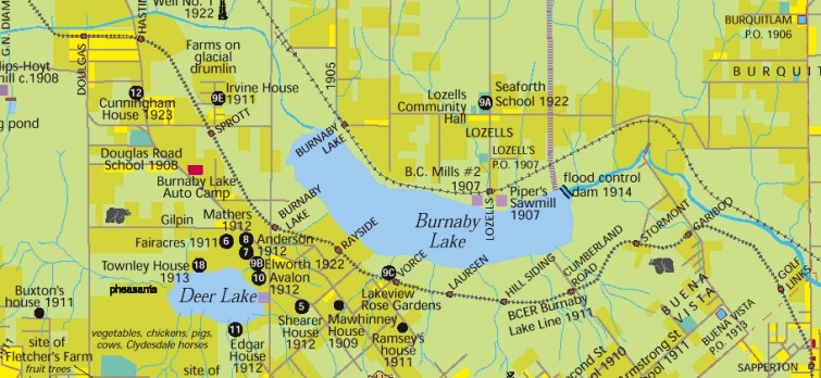
The Kingsway Interurban Line now serves a dual purpose for Skytrain and a linear bike path. The Burnaby Lake Line was a contender when Skytrain's Millennium Line was proposed but the Lougheed Highway route was chosen because an elevated track would be next to impossible to build along the Burnaby Lake lowlands. Several sections of the Burnaby Lake line still exist in varying forms of decay, parts of which have been incorporated into the parks system. Although it remains unused, he Arbutus route is the only trolley line which still has tracks.
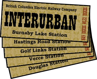
At each station there is a clear orange 120ml (half cup) container that contains a clue in the form of a trolley ticket. The clue can be seen without opening the cache but there are additional tickets inside for cachers that would like a hard copy. These microcaches are equipped with a child-poof lid so please be careful when opening and closing the containers. The Douglas, Hastings Road and Burnaby Lake Station caches should be more or less park and grab. There will be a 5 to 10 minute hike for the other Stations. Street and/or public parking is available close by for all but the final destination. Parking should not be a problem for any cache, however. No cache is accessible from the Highway. Vorce Station might be the trickiest to find. There are two ways to get to it -- one being at the end of Nursery Street (long route with brambles) and the other being a trail head that is mostly hidden from view at N49 14.199 W122 56.710 next to a "Park Site No Dumping" sign. The best way to get to Golf Links Station is via Sapperton Avenue or Craig Avenue.
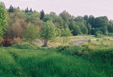
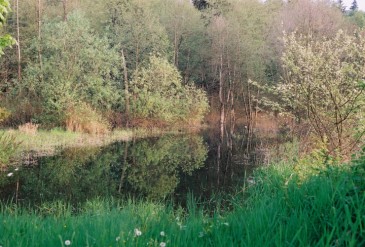
At the final destination, the trolley line was kept in good shape for many years as it was slated to become part of a highway cloverleaf interchange. However, it seems that the cloverleaf has also been abandoned. The roads have not been used for years. The trail head is easily seen from the nearby street. At one time, it was possible to take a long walk along the old trolley line but it seems that an enterprising beaver has dammed a drainage ditch. The resulting pond has totally flooded the low lying area of the roadbed, blocking access to anyone without a boat. The beaver dam can be seen around the corner from the edge of the pond on the north east side. The final cache is located between a few large rocks. You may leave your tickets there for recycling if you wish but please feel free to keep them as a souvenir gift from the Scruffster Historic Tour Caching Company. Enjoy your
visit.
|


 The
Burnaby Lake Line ceased operation in the Autumn of 1953. The
Kingsway
Line followed suit in 1954. The last trolley car in the lower
mainland
made its final run along the Steveston / Arbutus route in 1958 after 44
years of trouble-free service. Vancouver would not see public
rail
transit for almost thirty years.
The
Burnaby Lake Line ceased operation in the Autumn of 1953. The
Kingsway
Line followed suit in 1954. The last trolley car in the lower
mainland
made its final run along the Steveston / Arbutus route in 1958 after 44
years of trouble-free service. Vancouver would not see public
rail
transit for almost thirty years.  Today
there are ten British Columbia Electric Railway trolleys still in
existence.
Three are operational. For those who would like a taste of what
it
was like to travel on the electric railway, two of the trolleys have
found
a new life running between Science World and Granville Island.
The
Downtown Historic Railway Company hopes to expand the service to
Chinatown
and Gastown. A third trolley is currently being restored for the
Burnaby Village Museum.
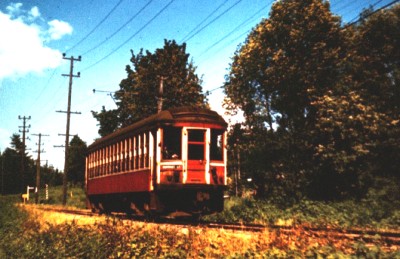
Today
there are ten British Columbia Electric Railway trolleys still in
existence.
Three are operational. For those who would like a taste of what
it
was like to travel on the electric railway, two of the trolleys have
found
a new life running between Science World and Granville Island.
The
Downtown Historic Railway Company hopes to expand the service to
Chinatown
and Gastown. A third trolley is currently being restored for the
Burnaby Village Museum.